
Sapulpa Neighbors Sources Around an Address
Each source answers a different block question. The Creek County map supplies adjoining parcels and public card fields. County deed records show an ownership sequence when the legal description matches. A voter-file request is a controlled state channel, not a street-browse search. Historical directories and the 1911 Sanborn set give an older address context, while association and civic listings can identify an organization rather than a full neighborhood roster.
| Source | What It Shows About a Block | Access |
|---|---|---|
| ArcGIS parcel buffer | Adjacent parcels, situs, parcel IDs, owner fields, and district layers | Public Creek County map; advertised 300-foot radius |
| County deed index | Recorded ownership sequence for an individual parcel | Creek County Land Records login or County Clerk counter |
| Voter data channel | Permitted public registration fields at a particular list date | State request route; protected records excluded |
| Historical criss-cross records | Past listed occupants at an address | Historical Society or library; years are incompletely published |
| Sanborn map | 1911 building footprint, use, street, and block context | Library of Congress public scan; not occupant proof |
| Plat and city code | Subdivision, common-area, and private-street obligations | City code, plat material, and County Clerk records |
| City permit request | Released construction, inspection, or certificate-of-occupancy history | SmartGov gateway or city request; public address index not located |
Owners and occupants are different categories. The assessor map identifies a titled or tax-listed owner, and a mailing field can point outside Sapulpa. A nearby parcel is a useful record lead, not proof that a named person is a current neighbor.
Use the Sapulpa Parcel Buffer
The Creek County Assessor Property Search has a map function described as a way to search or click a parcel and create a 300-foot radius buffer. This is the most direct local method for moving from one address to the nearby parcels. The research did not establish the current names of every live map control or a result cap, so use the map display and parcel cards rather than assuming a fixed screen layout.
The buffer is also a geography check. Turn on the map layers for city boundaries, subdivisions, blocks, lots, zoning, school, water, fire, and district areas. A property that feels adjacent can be in a different subdivision, on a private street, outside the city limit, or in an unincorporated pocket. Those details explain why civic services and association obligations may differ across a short distance.
Note: The map’s proximity tool organizes nearby parcels. It does not create a list of every resident connected to the block.
Map a Sapulpa Neighbor Block
Move from an address to a block in a fixed order. This keeps a neighbor search tied to land records instead of names alone. Parcel ID, situs, and legal description are the stable links between the assessor card and the County Clerk’s recorded documents. Retain the printed form of an address alongside its normalized street direction and abbreviation.
- Enter the target address in the assessor’s Address search, or locate the parcel by account or parcel ID.
- Click the target polygon, open its card, and record the situs, parcel ID, legal description, and owner field.
- Create the advertised 300-foot buffer, then open the cards for the surrounding polygons one at a time. Record only the parcel fields that each card displays.
- For an owner history, repeat the legal-description and deed search on each nearby parcel. Use the owner’s name as a deed-search lead, not as a claim about occupancy.
- For a longer named-street chain, use the Sapulpa Street Directory, which follows address-keyed records beyond the immediate block.
A plat can translate lot and block language into map geometry. Metes-and-bounds or section descriptions may not carry a modern street number, which is why the legal description should stay with every search note.
Read Sapulpa Neighbor Parcel Cards
A parcel card may contain owner name, mailing-address lines, city, state, ZIP code, situs, account, parcel ID, acreage, legal description, school district, value fields, sale date, sale price, neighborhood, and homestead information. The assessor labels the taxable physical location as situs or TrueSitus. Mailing fields are separate. A post-office box or a mailing city outside Sapulpa does not establish who is present at the property.
| Field | Block-use value |
|---|---|
| Parcel ID and account | Stable identifiers for opening the correct card and matching related records. |
| Situs or TrueSitus | Physical taxable location used for the address-side search. |
| Legal description | Crosswalk to deeds, plats, lot/block, and subdivision research. |
| Owner and mailing fields | Title and correspondence leads, not a complete occupant list. |
| Homestead flag | Exemption evidence to evaluate, not proof of a present household. |
The Mapping Department describes its maps as records of taxable land, legal descriptions, conveyances, and parcel relationships. That makes the map a bridge from address to property record, not a replacement for a deed image.
Sapulpa Neighbor Voter Records
The Oklahoma Voter Portal is an individual lookup, not a block-by-street tool. It uses a last name, first name, and date of birth. For a broader public file, request the current fields, format, and rules from the Election Board’s records channel. Readily available electronic records have no fee according to the state page, while paper copies are listed at $0.25 per page and certified copies at $1 per page. The Creek County Election Board is at 230 E Hobson in Sapulpa and can answer file or protected-record questions at 918-224-3529.
Registration address can be public unless it is protected. Full Social Security numbers, driver-license data, and ACP or Restricted Records addresses are confidential. A voter entry records registration at an address at a point in time. It does not prove that a person lives there now, that the household is complete, or how anyone voted.
Note: Never share a protected address or interpret an inactive registration status as proof that someone moved on a particular date.
Sapulpa Neighbor Community Contacts
Community listings are useful for meeting an association or finding a public program, but they are not resident directories. Research found no city-published master list of neighborhood associations. The City FAQ says many subdivisions have covenants or associations and that private streets are often association-maintained. It also states that the City does not enforce association covenants or deed restrictions. Treat an organization listing as a contact route, then confirm its current status and coverage with the organization.
| Community layer | Documented contact or evidence | What is not established |
|---|---|---|
| Freedom Park Homeowners Assoc., Inc. | Chamber association listing | Current activity, full member directory, and neighborhood coverage |
| Mayfield Estates HOA | Official plat and agenda material describes common-area, private-street, drainage, and restriction obligations | A public contact or member directory |
| Sapulpa Chamber | 101 E Dewey, 918-224-0170, info@sapulpachamber.com; public business search and events | A complete list of neighborhood residents |
| Kiwanis | Program page describes Thursday noon meetings at La Margarita and a membership path | A public member roster |
The Sapulpa Chamber directory shows category, keyword, alphabetical, and sort controls for its listed organizations.
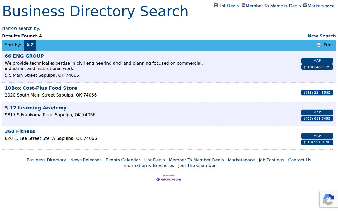
The Chamber layer can point to public organizations and association contacts. It should not be treated as a map of every household on a block.
Sapulpa Neighbor Source Comparison
Official records separate what a parcel, a deed, a registration channel, and an association listing can establish. Commercial neighbor-lookup services are a different category: they may combine public records, purchased data, and inferred connections. Those profiles can be old or mix people with similar names. When a record needs correction or certification, contact the official custodian rather than relying on a commercial profile.
| Source type | Useful for | Key limit |
|---|---|---|
| Assessor map and parcel card | Parcel geometry, owner field, situs, and legal description | Does not list all occupants or prove present occupancy |
| County Clerk deed record | Recorded title connection and legal-description chain | Online coverage and image access are not fully published |
| State voter channel | Permitted registration records at a list date | Not a block browser; protected fields stay protected |
| Commercial people-search category | Possible lead to verify independently | May be stale, combined, incomplete, or inaccurate |
If a commercial profile is wrong, category-level removal requests generally require locating the profile, completing the service’s verification step, saving the confirmation, and repeating the request if the data returns. That process does not correct the official record.
Sapulpa Neighbor Private Streets
A block can cross a private-street or subdivision boundary even when addresses appear close together. Sapulpa’s city code addresses planned developments, and the research identifies a rule that certain deeds must state that owners automatically become association members responsible for private streets and common areas. Mayfield Estates material specifically describes common areas, private streets, drainage, and recorded restrictions. These are land-record obligations, not a community roster.
The Sapulpa FAQ page addresses private streets, association restrictions, city-limit questions, and address questions.
Use a parcel’s legal description, map layer, plat, and recorded restrictions to understand the boundary. For a city permit record, provide the address, legal description, parcel ID, and approximate date through the SmartGov or public-request route because no public address archive was located. Do not assume a street label alone identifies the same municipal service area or association.
Note: A private-street obligation can explain who maintains a road, but it does not identify every person connected to nearby parcels.
Sapulpa Neighbor Privacy Limits
A neighbor lookup has clear limits. Parcel cards do not disclose every person at an address. Public records do not open utility customer data, protected voter addresses, sensitive identifiers, juvenile or sealed court records, or confidential adoption material. Oklahoma’s Address Confidentiality Program gives qualifying participants a substitute address and mail forwarding, while voter Restricted Records and ACP protections can keep registration or mailing information from public release.
For an exposed or incorrect assessor record, contact Creek County Assessor at 918-224-4508 or assessor@ccaook.com. For voter information, use the Creek County Election Board. For a city record, contact the City Clerk at 918-248-5913. Each agency has its own correction process, and a public-record request is not the same thing as a correction request.
Lawful use. Use Sapulpa neighbor records for personal research, community connection, family history, or a property question. Never use a name, address, or map result to stalk, harass, intimidate, or harm another person.